Big Yellow Bike Adventures: Red Deer, & Kamloops to Crazy Creek


BYB Adventures: 04/23 (27 Jun – 08 Jul 23) Blue Knights WCC Red Deer, AB (Tue, 27 Jun - Day #1) Kamloops to Crazy Creek (117 Miles = 188 kms)
Note: While I attempt to tell a story and share, I encourage you to check out the References/Cites I provide to truly gain the insight to the story and history I share.
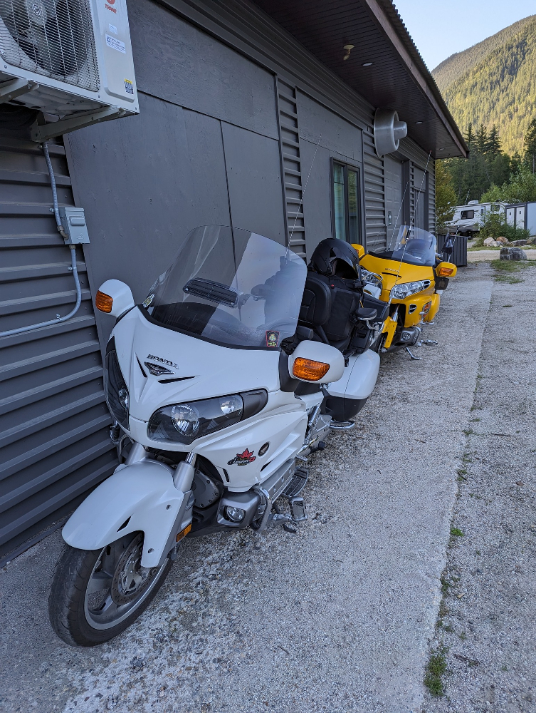
Now it is time to start my newest Blue Knight adventure with my friend Craig (Brenda Thomson), with the first leg of our journey up to Crazy Creek Resort in the area just West of Revelstoke (The actual area of Malakwa). Good start to get my new (overpriced) tires scrubbed in. Brenda was in the car as she is planning a weekend get-away with family at the resort and Craig and I are simply tagging along for the one evening.
It was business as usual until I got to stop at a place I wanted to stop at several times. Just outside of Sicamous is a unique shaped building which was converted to a diner and is known as The Burner Grille (Cite 1). Note the building is currently up for sale and the web site has expired. Apparently it was on “You Gotta Eat Here”, Season 4, Episode 14. Unfortunately it is closed up and I was not able to get any pics of the inside.
This was made from what was a Beehive Burner (Cite 2) which the original purpose was to burn the mill waste from lumber mills.
{Teepee or beehive burners are used to dispose of waste wood in logging yards and sawdust from sawmills by incineration. As a result, they produce a large quantity of smoke and ash, which is vented directly into the atmosphere without filtering, contributing to poor air quality. The burners are considered to be a major source of air pollution and have been phased out in most areas. There are a few beehive burners remaining in Western Canada.}
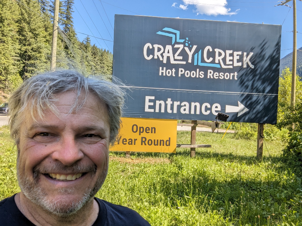
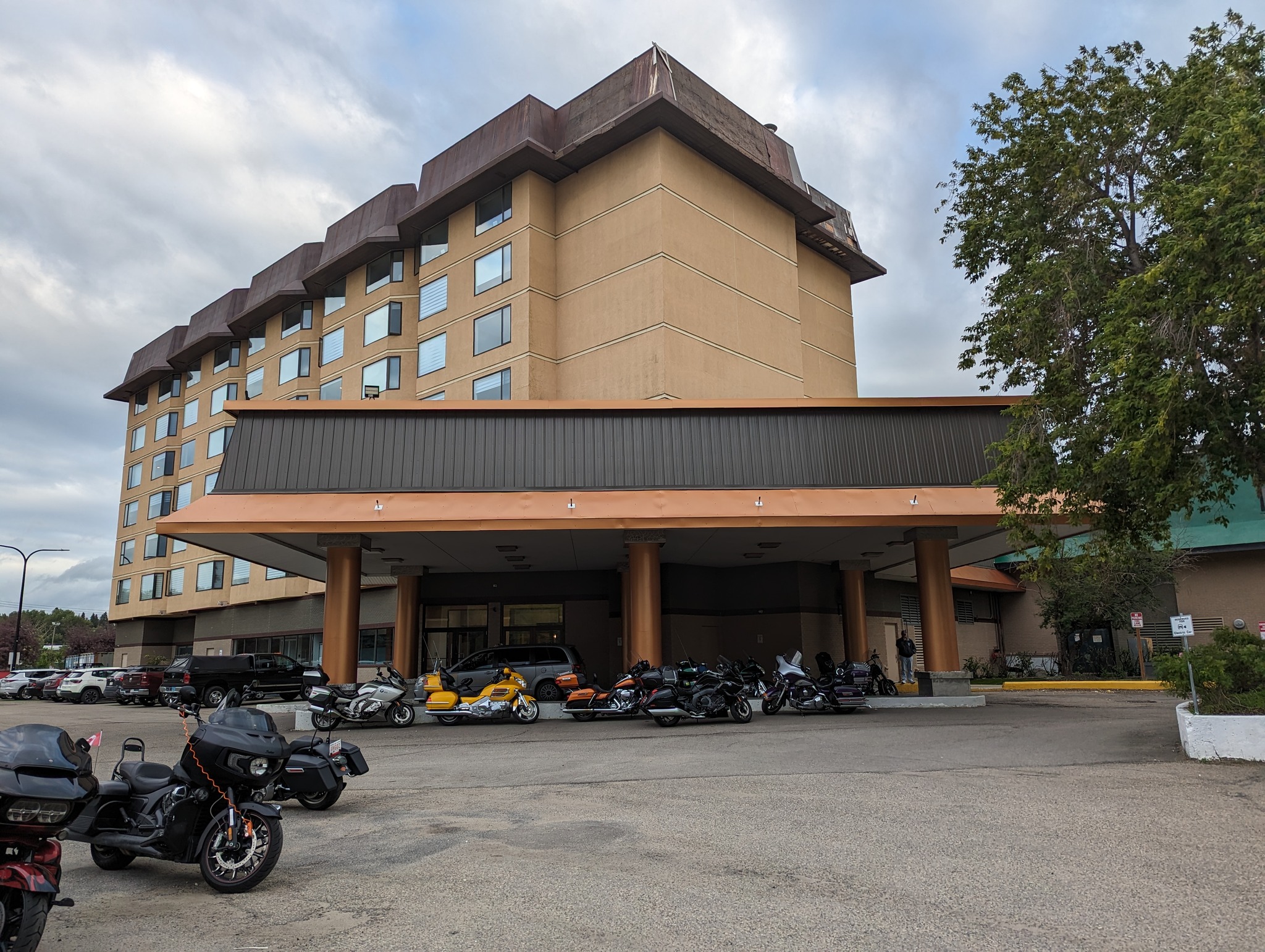
We finally arrived at our destination, Crazy Creek Resort (Cite 3). Which is built on and combining some items from the historic railway and mill town of Taft (Cite 4).
{Taft was a mill and railway town established in the late 1800s. The town was named after the manager of the Heed Lumber Company by the Canadian Pacific Railway. The Heed Lumber Company operated a logging railway in the town at that time. Much of the settlement of Taft, BC, has now faded away, but the old remains can still be explored via heritage trails. Of the old settlements, remains of the general store, sawmill, hotel, and train station can still be seen. This ghostly walk-through history will bring you closer to the railway settlement way of life responsible for developing much of western Canada and the Rockies.}
I walked around the area, visited the beach area of the river, around the railway tracks and onto the ruins of the old rail station. It is neat to see the old buildings of what was a Fish Hatchery converted over to really nice rooms to rent and we stayed in #7.
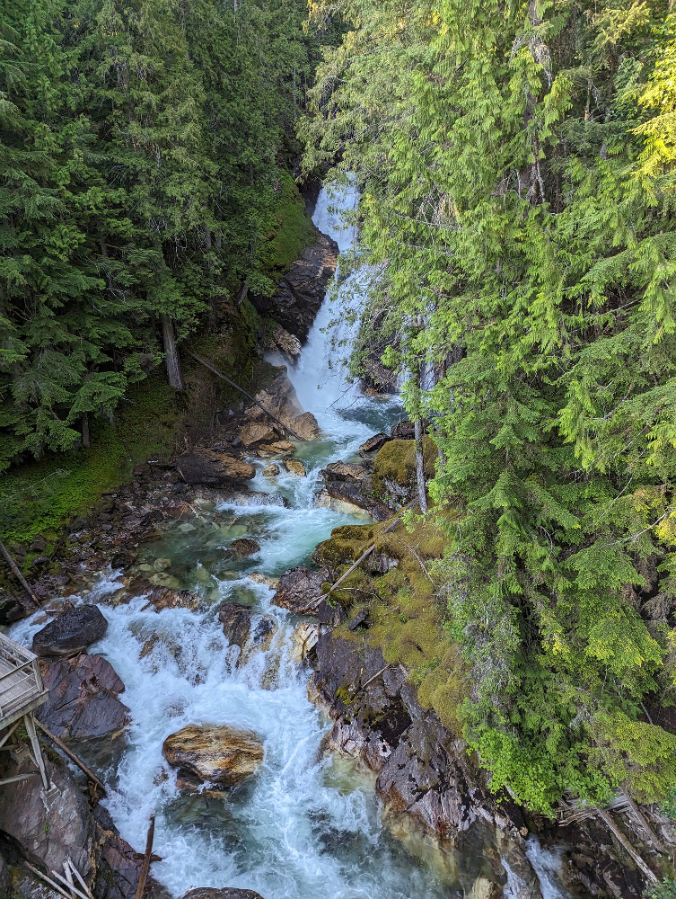
After walking the area, I found myself walking up to check out the suspension bridge and falls (Cite 5).
{Crazy Creek Waterfalls are located on the Trans-Canada Hwy, west of Revelstoke, British Columbia. The spectacular falls have two stages (approx. 100 feet) with a natural pool part of the way down. Walk the 240ft suspension bridge, built in 2004, that runs directly in front and boardwalks and viewing platforms surrounding the gorge.
The attraction is easily accessible off Highway #1. Crazy Creek drains 119 sq km of mountain country, it all converges at this gorge. The waterfalls continue to be viewed by visitors from around the world. You can even relax in the Hot Pools and see a portion of the waterfalls. The design of this suspension bridge is well-suited for a pedestrian crossing over the deep canyon and was constructed with minimum impact upon the environment.
The structure is a single span in which the bridge deck is suspended on hanger cables of uniform length and follows the profile of the main suspension cables with an overall sag of approximately nine feet at mid-span. In addition to pedestrian traffic based on an average live load of 104 pounds per square foot, Crazy Creek Suspension Bridge carries a number of electrical conduits for lighting, sound and security. It is easily navigated by most ages.}
Chilled out and relaxed in all four pools and then it was time to hit the hay for the evening but not before checking out the temp gauge on the BYB which showed a temp of 106 F or 41 C…just a tad warmish.
References used/cited in the writing of this article:
Cite 1: https://www.facebook.com/TheBurnerGrille/
Cite 2: https://en.wikipedia.org/wiki/Beehive_burner
Cite 3: https://www.crazycreekresort.com/
Cite 4: https://bcrdh.ca/islandora/object/revelstoke%3A24067
Cite 5: https://www.crazycreekresort.com/waterfalls-suspension…
Day # 2 - Tire Day
Crazy Creek to Red Deer (401 Miles = 645 kms) Day #3
While in Kamloops I really did nothing except get my tires put on and I am sure some of you may have read my RANT…what I forgot to mention is that as I was leaving, the Service Rep said in defence of the price they were going to charge and what was charged was simply; “But we do good work”.
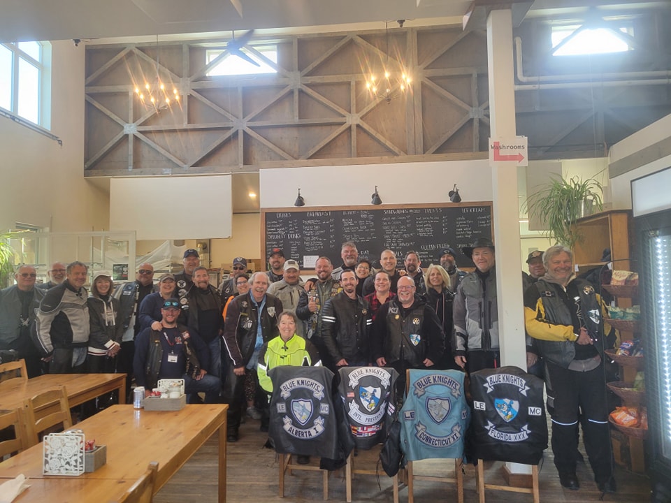
Happy Canada day and it is time to head into Red Deer and meet up with many Blue Knights and their families at the annual West Coast Conference.
This will be a short version of story time. Riding up the miles we rode without incident into the very flat province of Alberta (flat in that after Canmore it is that way). The ride through Golden and the new construction was impressive. Into lake Louise for a quick stretch and then it was the straight shot into the Calgary area to go North to Red Deer.
As we departed the Lake Louise area, we could not help but notice the volume of traffic heading West. The highway is a four lane divided highway and it really was bumper to bumper heading out of Calgary for the entire distance between Calgary and lake Louise (That is a distance of about 200 km!! – a 2 hour drive on a normal day). However, as seen in the video this was pretty much bumper to bumper and vehicles were travelling at a speed of about 30 – 50 km if that and at times stopped.
Based on this (thank goodness) we decided to head North on Hwy 22 at Cochran. Once we stopped there it was the baddest and blackest skies I have seen in forever on the horizon. We decided that the sky was off to the east a bit so a run up the 22 past Sundre and into the Caroline area was best.
Thank goodness as we reported one of the strongest tornadoes (Cite 1 & 2) to hit the area did so and touched down right onto the path we were to take. It was rated at an EF-5, measuring up to 2 km wide! Wind speeds up to 275 kms!
Once we went around it the skies changed within 20 min to an overall gray. No rain fell on us, no hail or anything so we made the right choice, and we were safe. So were the other 100 plus riders heading to Red Deer with us that day, however some hit a lot of rain.
References used/cited in the writing of this article:
Cite 1: https://www.msn.com/.../damage-from-alberta.../ar-AA1dqlxb
Cite 2: https://www.cbc.ca/.../emergency-albert-weather-climate…
Blue Knights WCC Red Deer, AB (Sun, 02 Jul, Day #6)
Red Deer area and Penhold (99 Miles = 159 kms)
Note: While I attempt to tell a story and share, I encourage you to check out the References/Cites I provide to truly gain the insight to the story and history I share.
The day seemed nice, and I wanted to see something in the area and as such on our way into Red Deer we passed by the old CFS Penhold (Cite 1 & 2) so I wanted to check it out.
{RCAF Station Penhold was a Second World War British Commonwealth Air Training Plan (BCATP) station located near Penhold, Alberta, Canada. In 1939, farmland was purchased, and land cleared for the future base. In 1940 the base opened as a Royal Canadian Air Force (RCAF) Manning Depot with one building. Five hangars and 31 other buildings were under construction well into 1941 including barracks, service buildings and administrative buildings. Six hard surfaced runways 900 to 1075 metres long made up the airfield. Two additional hangars were built for a total of seven. In August 1941, the base was handed over to the Royal Air Force and on 28 September 1941, No. 36 Service Flying Training School was transferred from Britain. It was one of several schools established as part of the British Commonwealth Air Training Plan.[1] The school was disbanded on 3 November 1944.[2] and the base was officially handed back to the RCAF who began the process of closing the base. The station was operated and administered by the Royal Canadian Air Force (RCAF). The station was also home to a Pinetree Line radar station and the provincial emergency government headquarters bunker for the province of Alberta. The remainder of the base continued in operation as CFB Penhold, although it was downgraded to a detachment of CFB Edmonton in 1990. In 1994 the base was decommissioned and closed.}
Riding out to the old base there was not much left to show it was a military location. The airfield now is the regional airport for Red Deer and area. A lot of the PMQs are still there and have been bought out by civilians and quite the community is there. Inside what was the base proper there still are the remaining HQ, Messes, barracks, supply, and hangers. I never been there but as a kid in Air cadets I had heard of it as a Cadet Summer Camp.
We went for a ride around the area but winds increased to close to 75=80 kms so it was a short day and back to the hotel for a soak in the hot tub, and some networking.
References used/cited in the writing of this article:
Cite 1: https://en.wikipedia.org/wiki/RCAF_Station_Penhold
Cite 2: http://www.springbrookwaskasoo.com/CFBPenhold.htm
Cite 3: https://penholdbase.ca/
Blue Knights WCC Red Deer, AB (Mon, 03 Jul, Day #7)
Red Deer area (111 Miles = 179 kms)
Note: While I attempt to tell a story and share, I encourage you to check out the References/Cites I provide to truly gain the insight to the story and history I share.
I made a promise as I was asked to “Sweep” for the back of a local ride, and I am a man of my word even though it was cold and started to rain. LOL, we were four bikes and one pickup in total, so this should be interesting.
One of the local Blue Knights wanted to show us the area so off we went because it was about riding at these events. Off in the rain we go and after a bit it just got a tad worse, and we made a stop at his home for a break but not before we got to see a “Prairie Moose” and her two calves. It just struck me funny seeing them in a farmer’s field.
At the house I befriended the three dogs, and we played catch for a bit but my fave new buddy was the little black cat who was an exception mouser, but he was so affectionate.
After the break we took a quick ride out to the Dixson Dam (Cite 1).
{Dickson Dam is a flow regulation dam constructed in 1983 which impounded the Red Deer River creating a reservoir known as Gleniffer Lake (Alberta). The dam is located 20 km (12 mi) west of the town of Innisfail and 50 km (31 mi) southwest of the city of Red Deer. The dam was created to control for floods and low winter flows, to improve quality of the river, to create a recreational resource and to provide a reliable, year-round water supply sufficient for future industrial, regional and municipal growth.}
Due to the weather we headed back to the hotel were I helped around hosting the “evening social”.
References used/cited in the writing of this article:
Cite 1: https://en.wikipedia.org/wiki/Dickson_Dam
Blue Knights WCC Red Deer, AB (Tue, 04 Jul, Day #8)
Lake Louise and Back (439 Miles = 707 kms)
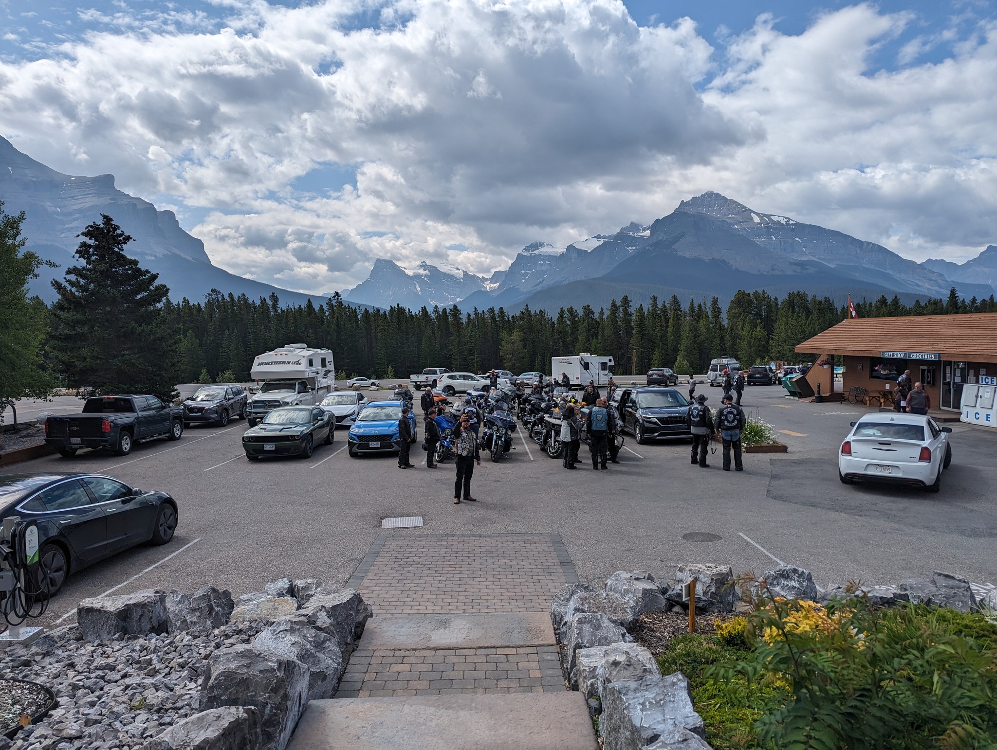
Today I am helping my friend Eric Larson with running lead on the second packet of 20 bikes heading out to Lake Louise and area via Hwy 11 into Sask River Crossing and then around to the Calgary area and back. A long day is in store. Especially since it is on the cool side. We have friends riding here from Florida who were scene putting on long johns and plugging in their electric vests, while looking for toque to wear inside their helmets…giggle.
I have never ridden this route 11 before so I am looking forward to it. Also, I have a Parks Canada Pass which I can use to help our guys out when we get to the park (unbeknownst to use the ticket booth at Sask River Crossing is closed so it looks like a free ride for our guys.
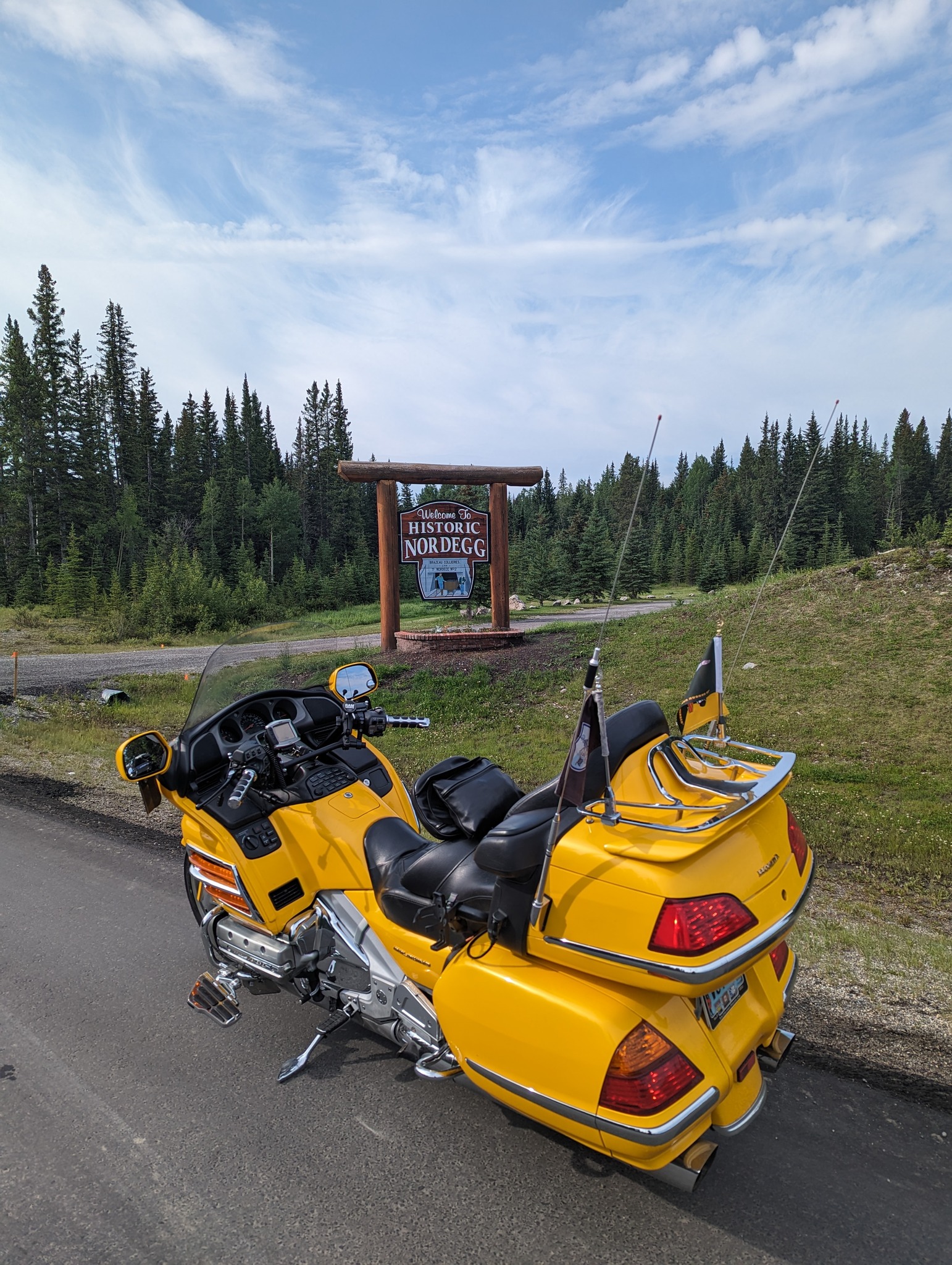
Our first port of call was the area known as Nordegg (Cite 1).
{A former coal mining town, it was named after Martin Nordegg and the name probably means "North Corner" in a German dialect.}
{A small camp was established at the future townsite in 1911, coal production began in earnest in 1912, and the rail line, known as the Brazeau Branch, arrived at the town in 1913. When World War I broke out, German assets in Canada were frozen. Martin Nordegg was permitted to remain at the town and supervise operations, but in the summer of 1915 he was asked to leave Canada. He was allowed to return in 1921, but he had lost his position with the mine. On 31 October 1941, a large underground explosion in the No. 3 Mine killed 29 miners.[3][6] Mining resumed six weeks later, and during 1942 the Nordegg mine was one of the top coal-producing mines in Alberta. In 1950, a fire destroyed the tipple and five wooden briquetting plants. A new, more modern briquetting plant was then built of metal. It began operation at the end of 1951 but a large government debt had been incurred for its construction. Coal markets declined, primarily due to the decreasing use of steam coal as railroads replaced steam locomotives with diesel, and Brazeau Collieries closed permanently in 1955.}
We stopped for a stretch, a pee and of course some of the world-famous pie in all of Alberta if not most of Western Canada. I am speaking of course about The Miners Café (Cite 2). This place has 4,5 reviews on just about every website which reports such.
From there we are heading into Saskatchewan River Crossing where we stopped for a break and took note of what normally is the most expensive gas in Canada is only now $2.00/litre this time out.
From there it was points south and it was interesting listening to some of the guys from the east coast, Florida, Carolina and away from mountains. They were overwhelmed with the size, the glaciers and the colour of the lakes and ponds.
Stopping in Lake Louise we could see a police presence resulting from the fire (Cite 3) which took out the residence (Staff Housing), which is next too the Petro Canada station which we used to stop at. 160 people are now homeless who work for the resort town.
All was going well until…one of our riders dropped his Goldwing and broke off his front peg. Trying to get it fixed was not an option so…we MacGyver’d a fix. Using a pair of locking vice grips, some zap straps we configured a temp set up to get him operational and home. The need for a temporary rest to the back break could be used was the goal as he had highway pegs he could use once up and running.
By the time it was fixed it was time for the main group to get rolling as we were expecting T&L storm in the area. I volunteered to get him back to Red Deer the fastest way so the others left. He had lunch while I stayed with the bikes and then an hour later we headed out down towards Calgary dancing with two major storms on each side of the highway but without getting wet. I switched up our route once we got to Cochrane and as such, we outran the storms and ending up riding in T-Shirts within the hour.
Arriving in Red Deer we arrived about 10 min before the main group got back…after riding in the rain.
References used/cited in the writing of this article:
Cite 1: https://en.wikipedia.org/wiki/Nordegg
Cite 2: https://www.minerscafe.ca/
Cite 3: https://www.msn.com/.../residents-of-lake.../ar-AA1dqMNP
Blue Knights WCC Red Deer, AB (Wed, 05 Jul, Day #9)
Escort to the RCMP (125 Miles = 201 kms )
A short day today.
Shout out to the BK and Alberta 1 for securing a sponsorship with Turple Brothers (Cite 1) in Red Deer.
{Turple Bros. Ltd. officially opened in Red Deer in 1956. It is still family owned and operated, with its passionate founder, Glenn Turple, leading the way. What started as the dream of two brothers has turned into one of the most well-known powersports dealerships in the area.}
While there we were personally met with the owner who is now the daughter of the founder, and she took the time to chat. She shared that her father is still with us at the age of 92 and still rides year-round. A Spyder in the summer and a Wing Trike in the winter.
I found a new set of riding gloves as my set from 2011/2012 finally had one of the fingers worn through.
I was later the lead bike to take our guests down to the RCMP Police Dog Training Centre (Cite 2. 3 & 4) located in Bowden. I have visited a couple of these over the years so I decided to get a pic or two and ride back to get ready for our banquet this evening and then pack and prep for our ride back to Kamloops tomorrow.
{The RCMP's history with police dogs goes back to 1935 when the very first Police Dog Section was formed with three German Shepherds. Within just two years, the value of the program was so obvious that a national training school for dogs and handlers was set up in Calgary, Alberta. In 1940, the very first case was won based on evidence seized during an RCMP police dog search.}
{The term “K-9” is short for the species “canine”. All RCMP vehicles with K-9 on the side of the car will have a working police dog in the vehicle. The Royal Canadian Mounted Police officially welcomed Police Service Dogs into the force with the establishment of the RCMP Dog Section in 1935. Prior to this date, some members of the Force used their own personal dogs in searches for missing people.}
{The Force had a relationship with dogs even before it started training them as police service dogs. The RCMP’s history with dogs dates back to the 1890s when the North-West Mounted Police (NWMP) stationed in the Yukon took on the responsibility of delivering mail in the winter. These dogs were not considered police service dogs.}
{In 1898, members and special constables delivered mail by dogsled patrol along a 960 km (600 mile) route between Dawson City, Yukon across the border to Skagway, Alaska. During the winter of 1898-99, the Mounties delivered more than six tons of mail by dogsled and traveled more than 100,000 km (64,000 miles). The NWMP set out on mail deliveries twice a month along this route either on the frozen Yukon River or along rough trails.}
{During this time, the NWMP hired Inuit as Special Constables to assist local detachments, as many members were unfamiliar with the area and terrain. The Inuit were an essential part of the success of numerous dog sled patrols; they assisted the Mounties whose tasks in these regions ranged from law enforcement to mail delivery.}
{Members of the Force started using their own personal dogs to assist in searching for individuals as early as 1908. The force’s official Police Dog Section was established in 1935 and consisted of three German shepherds: Black Lux, Dale, and Sultan. Within just two years, the value of the program was evident, and the force established a national training school for dogs in Calgary, Alberta. In 1940, evidence seized with the help of an RCMP police dog helped secure a conviction for the very first time. PSD Black Lux found a liquor cache and that evidence led to a conviction under the Excise Act in February of that year.}
{The RCMP’s relationship with its police dogs has also been a subject of pop culture. A 1930s radio series “Challenge of the Yukon” introduced listeners to the Mounties and their police dogs. The radio show became “Sergeant Preston of the Yukon” on radio and television in the 1950s and featured Sgt. Preston and his trusty side kick. “Yukon King – an Alaskan Malamute.”}
{The force has always been attentive to the specific needs of its police dogs. For example, the Police Dog Service unit was the first Unit in the RCMP to have air conditioning as standard equipment in its vehicles. Dogs “see” more with their nose than their eyes. If the dog is hot, they will pant to cool themselves which can affect their ability to track. Today, there are more than 150 Police Dog Teams in the force. These teams are an important part of frontline policing that search for missing people, track down criminals, remove illicit drugs from the streets, and even sniff out explosives and human remains.}
References used/cited in the writing of this article:
Cite 1 : https://turplebros.ca/
Cite 2: https://www.rcmp-grc.gc.ca/policedogs.../pdstc-cdcp-eng.htm
Cite 3: https://www.youtube.com/watch?v=-7yA5bUTI0s
Cite 4: https://rcmphc.com/.../blog-dogs-have-played-many-roles…
Blue Knights WCC Red Deer, AB (Thurs, 06 Jul, Day #10)
Red Deer back to Kamloops (469 Miles = 753 kms)
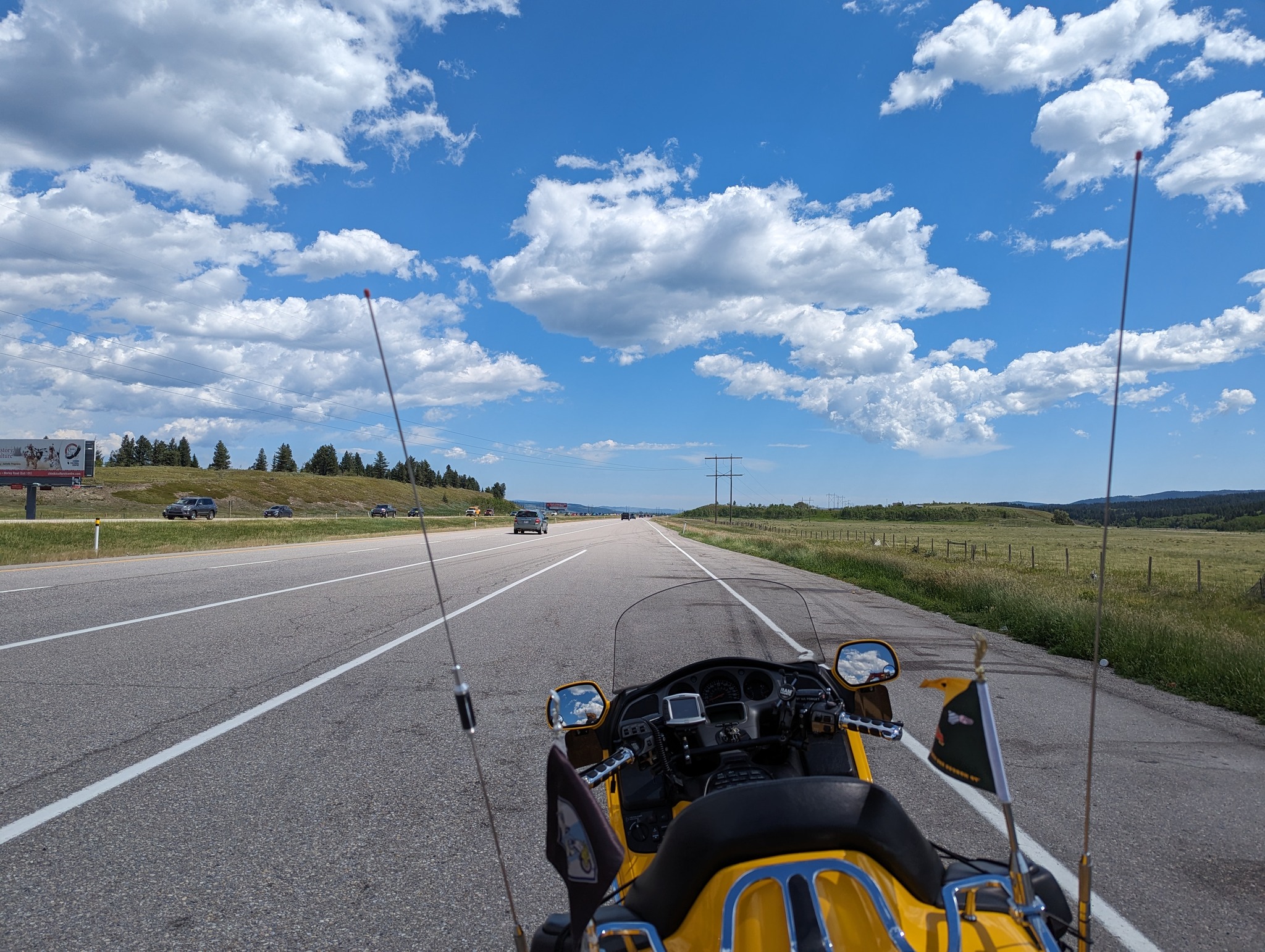
Today is the last day of our adventure and it is time for Craig and I to head home. The route today will be the 2A south to Cochrane, then the 1A to Canmore, hop back on the 1A to Laker Louise and then the TCH back to Kamloops.
I enjoy travelling more of the back roads and if you are in this area, I highly recommend (if you have the time and not on any particular schedule) to take advantage of the 2A and the 1A. While the 1A in Banff National Park is called the Bow Valley Parkway with speeds only around 60 kms for a lot of the ride it is worth the break of the highway. Also, there was no one checking on park passes so it was a free ride today.
Leaving Red Deer, we traveled past the community of Didsbury and just South of the town was the area the tornado struck, right across the 2A and into the homes and farms. I did not stop to take pics only because it was signed to not stop but there were people on the properties, and it just did not feel right to intrude upon them at this time. So, all the pics I post are stock from the internet but this is what we saw.
It is pleasant on the side roads, no real traffic to speak of and more important is that there is not a sense of being in a hurry and one can actually enjoy what is around them. Speaking of such once again we got to see two prairie moose in a farmer's field running along beside the highway racing us. Not bad to see 5 moose over a 3-day period.
The weather is great and the company is better. Craig and I both run with CBs (yep, low tech) and we can have a conversation along the way. Topping up in Cochrane we headed down the first part of the 1A. Hardly any traffic to speak of, nice slow twisties and such thru the foothills of AB, and no rat race of highway traffic. I am thinking in two weeks time this is the route I will travel again on my way to NL.
Back on the TCH for a bit then off again on the Bow Valley Parkway/1A but this time inside the park. Speeds are down to 60 km but it is a chill ride with little traffic but even the slower traffic is easy to pass on the BYB.
We arrived at the off ramp to Emerald Lake at about 1140 and then waited a little bit for the 15th Annual MPNMR to arrive to surprise them. I played with the camera and a few natural pics of the flowers and such when I grabbed a video of the 6 bikes of the MPNMR arriving, chatting, and then departing. It was nice to see them and then did not recognize the guy videoing them, but they did recognize the BYB, lol.
Off we went heading West and they East. Getting into Golden and the incredible engineering work they are doing at Kicking Horse Pass is breathtaking and progressing quite fast I might say.
A quick bite to eat in Golden, more fuel and off we rode without notable incident back to Kamloops where we called it a day and it was there, I said bye to Craig for a few days until he and Brenda come to Victoria for the Inside Passage tour on the 15th.
Thank you once again for joining me along this BYB journey.
The next morning, I simply scooted back down the Canyon to the ferry and home. Since I have ridden this route and written about it numerous times it was just me and the BYB this time with nothing to share with all of you. Follow me on Facebook: https://www.facebook.com/groups/595397150602105/
Looking Thru The Lens:
A Traveller’s Tale, Featuring The Big Yellow Bike
By Lamont French

Suzie Healey